Good Morning. This is Doug Chabot with the Gallatin National Forest Avalanche Forecast on Thursday, Christmas Eve, December 24th at 7:15 a.m. This forecast is sponsored by Grizzly Outfitters and Montana Chevy Dealers. This forecast does not apply to operating ski areas.
There is no new snow to report and none is expected until Saturday. Wind, on the other hand, is in ample supply. West winds are blowing strongest in the north at 20-40 mph and 5-15 mph in the southern ranges. These speeds will subside today. Under sunny skies, temperatures are in the single digits to teens and will warm into the low 20s. It’ll be a clear night of smooth sailing for Santa. I can’t wait to get my new lump of coal.
In the Bridger Range and in Hyalite, yesterday morning’s 12-14” of new snow got blown into drifts. Near the ridgeline, pillows of windblown snow will easily crack and avalanche with a human trigger. The snowpack is weak with half to two-thirds of it being sugary facets that are unsupportable. If you step out of your skis or off your machine you’ll sink to the ground. Tuesday and Wednesday’s snow capped these facets and the interface between the two is unstable. Dave found this in Divide Peak yesterday when he saw a recent avalanche and got a large “whumpf” (video). For today, avoid wind-loaded slopes since these have a CONSIDERABLE avalanche danger. All other slopes have a MODERATE danger.
In the entire Madison Range, southern Gallatin Range and Lionhead area, the snow structure is unstable. The snowpack’s lower half is weak, sugary, faceted snow. Snowfall in the last 7 days has capped this layer with a dense slab. These two layers are plainly visible in a snowpit and are easily breaking in tests. Yesterday, skiers in Beehive Basin, Bacon Rind and Telemark Meadows all got poor stability test results at this interface of facets and newer snow. On Monday, Dave and Alex found similar conditions in Taylor Fork (video). Without further loading the odds of triggering a slide decrease, but because the snow structure is so poor we inherently don't trust it and neither should you. Signs of instability such as shooting cracks, whumpfs or fresh avalanches are warnings to not get on a steep slope. For today the avalanche danger is rated MODERATE on all slopes.
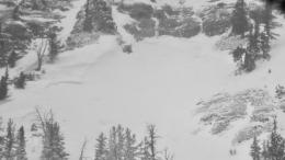
The avalanche danger in Cooke City is decreasing after spiking Tuesday from heavy snowfall and wickedly strong swirling wind (over 2’ of snow measuring 2.2” snow water equivalent with 75 mph gusts). Ian and I spent the last 2 days hunting for avalanches, digging pits, and doing stability tests (Tue video, Wed video). What we found is promising. There were many natural avalanches in steep, rocky, wind-loaded slopes. Most were small to medium sized and involved the new snow. There is no widespread weak layer that we are concerned about and active loading of the snowpack has been curtailed since winds have died down. This good news is tempered by the fact it’s still possible to trigger avalanches on steep, wind-loaded areas, or slopes that are thin and harbor weak, sugary facets. Yesterday’s reported signs of instability include a fresh avalanche on Miller Mountain (photo) and collapsing (whumpfs) at lower elevations. For today, the avalanche danger is rated MODERATE since triggering avalanches on skis or a snowmobile is possible.
On our website we listed natural and skier triggered avalanche activity and posted many avalanche photos. Thanks to everyone who sent in observations!
If you get out, please send us your observations no matter how brief. You can submit them via our website, email (mtavalanche@gmail.com), phone (406-587-6984), or Instagram (#gnfacobs).
Upcoming Avalanche Education and Events
See our education calendar for an up to date list of all local classes. Here are a few select upcoming events and opportunities to check out:
Every Saturday in Cooke City, FREE snowpack update and rescue practice at the Round Lake Warming Hut between 10 a.m. and 3 p.m. Poster with More Info.
January 20 & 21 (plus field sessions the following weekends), Avalanche Fundamentals with Field Course. There are separate field sessions tailored for both skiers and splitboarders (Bridger Bowl) and snowmobilers (Buck Ridge). Register here.
There have been four avalanche fatalities in the mountains of CO and WY since Friday. We are deeply saddened by these events. You can find preliminary reports at https://avalanche.state.co.us/accidents/us/


