Good morning. This is Ian Hoyer with the Gallatin National Forest Avalanche Forecast on New Year’s Eve, Saturday, December 31st at 7:00 a.m. This information is sponsored by Knoff Group Real Estate, Cooke City Motorsports, and Bridger Bowl. This forecast does not apply to operating ski areas.
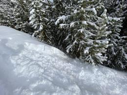
This morning, there are 4-6” of new snow around West Yellowstone, Big Sky, and Cooke City, with a trace-2” near Bozeman. Winds are 10-15 mph out of the southwest and west with gusts of 30-40 mph. Temperatures are in the high teens and low 20s F. Temperatures today will rise into the mid-high 20s F. Moderate west and southwest winds will continue. A couple inches of snow are possible before snowfall tapers off later this morning.
Triggering large avalanches is a serious possibility today. You could trigger an avalanche within the snow that’s fallen over the last week, on a weak layer buried just beneath that, or deep in the snowpack (Taylor Fork video). Continued loading every day this last week by new snow and wind drifting has kept stressing the weak layers and building thicker and more cohesive slabs of fresh snow. In general, the snowpack has been able to keep up and accommodate the loading. Triggering slides has become slightly less likely, but by no means does that mean conditions are safe. While the likelihood has gone down a little bit, the potential size and destructive power has not decreased.
As Alex identified in yesterday’s video from Cooke City, wind loaded slopes are where you’re most likely to trigger a slide today (Cooke City video). Steering clear of wind drifts altogether would be a wise call. Watch for signs of instability in the new snow, such are shooting cracks, collapses or recent avalanches. Assessing the deeper weak layers will be harder. Snowpack tests aren’t necessarily going to give you actionable information. For now, simply don’t trust those deeper weak layers. Tone down your objectives appropriately for the possibility of triggering large, deep slides (explosive triggered hard slab at Big Sky Resort).
If you’re considering riding steep slopes today, ponder this analogy: as we’ve gotten a few days out from the last rapid loading event (which hit particularly hard in the southern areas) we’ve removed a couple bullets from the gun you’re playing russian roulette with. But the gun’s still got at least one bullet left. Is that really a game you want to play today? As an alternative, mellow slopes (less than 30 degrees steep) will hold good riding conditions without the risk.
Human triggered avalanches remain possible and the avalanche danger is MODERATE.
Please share avalanche, snowpack or weather observations via our website, email (mtavalanche@gmail.com), phone (406-587-6984), or Instagram (#gnfacobs).
Triggering large avalanches is a serious possibility today. You could trigger an avalanche within the snow that’s fallen over the last week, on a weak layer buried just beneath that, or deep in the snowpack. Steering clear of wind drifts altogether would be a wise call. Tone down your objectives appropriately for the possibility of triggering large, deep slides.
Upcoming Avalanche Education and Events
Our education calendar is full of awareness lectures and field courses. Check it out: Events and Education Calendar.
January 4 + field day on January 7 or 8, Avalanche Fundamentals for Snowmobilers, Information and pre-registration HERE.
January 4 + field day, Avalanche Fundamentals for Skiers and Snowboarders, Information and pre-registration HERE.
Every Saturday, 10 a.m. - 2:00 p.m. Avalanche Rescue Training, drop in for any amount of time. Round Lake Warming Hut, Cooke City. Free.
Loss in the Outdoors, is a support group for those who have been affected by grief and loss related to outdoor pursuits. Check out the link for more information.
Please consider donating to the Friends of GNFAC Annual Fundraiser.
In Colorado on December 26th 4 backcountry tourers were caught, 2 fully buried, and 1 killed. Four people were on the slope at the same time. Let’s all pause and learn from this tragedy.


